


 24/7 Emergency Service
New Map Can Track Hurricane Flooding From Florida to Maine
11/7/2014 (Permalink)
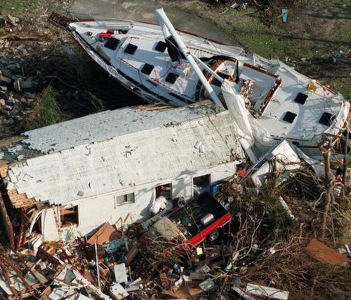 Storm surge from Hurricane Andrew swept cars, boats, and houses inland in South Miami-Dade County in 1992.
With about 22 million people vulnerable to dangerous hurricane storm surges, forecasters have long struggled over how to issue warnings, especially in low-lying Florida, where waters can rise far inland.
Now they have an interactive map that tracks flooding not only by location, but storm strength.
Published Thursday, the map for the first time links the coast from Texas to Maine, said Brian Zachary, a National Hurricane Center storm surge specialist. Forecasters used thousands of hypothetical hurricanes and factored in local coastal topography along with levees, canals and other structures to determine flooding.
In Florida, they found that about 40 percent of the population could face flooding in a powerful storm.
“Storm surge isn’t just, ‘I live on the coast. OK, I’m vulnerable,’” Zachary said. “It can go 10, 15 or 30 miles inland.”
The maps are an improvement on the disconnected grids forecasters had previously used that sometimes left the public confused. The new map lets users choose the strength size, then zoom in and out of locations, tracking flooding, which is measured at three, six and nine feet above ground.
Not surprisingly, only a narrow ribbon of coast south of downtown Miami is expected to flood in a Category 1 storm. But jump to a Category 5 hurricane and the south end of the county, including Kendall, Cutler Bay, Homestead, Florida City and all of the Everglades, would sit under six to nine feet of water. Under the same scenario farther north, the central part of the county stretches like a chain of ragged keys, with dry land forming a narrow corridor around Southwest Eighth Street between Miami and West Miami. The northern half of Miami-Dade and northern Broward County fare much better.
The map arrives just as a mostly quiet Atlantic hurricane season winds down. Rather than wait until next year, Zachary said forecasters decided to release it now to give residents more time to study it and contact local emergency managers for information on evacuation plans.
“This is for the general public to look at and say, ‘OK, I’m in a storm surge area and what should I do?’” Zachary said.