


 24/7 Emergency Service
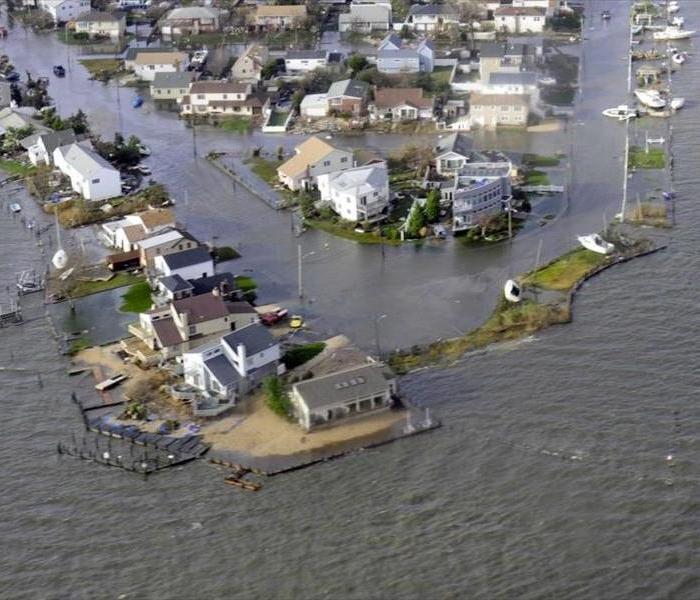
Hurricane Season Largely Passed Long Island By
12/5/2014 (Permalink)
Reprinted by Newsday.com
Long Island got a welcome pass this season from hurricane activity, with the only minor impact being ripple effects from the fringes of Hurricane Arthur, which tracked well to the east on the Fourth of July.
Indeed, overall it "will be remembered as a relatively quiet season," as was predicted, according to the National Oceanic and Atmospheric Administration in a wrap-up of the Atlantic season that started June 1 and ended Sunday.
Arthur came the closest to the Island, "but no direct impacts were felt other than larger waves, higher surf, higher rip current activity, and prolonged rain through the day," said John Murray, a National Weather Service meteorologist based in Upton.
In all, there were eight named storms -- from Arthur in July to Hanna in October -- with seven to 12 predicted in the August outlook from NOAA's Climate Prediction Center.
Six of those storms became hurricanes, with three to six predicted. Of them, two became major, category 3 or up -- Edouard in September and Gonzalo in October -- with zero to two predicted.
That's compared to the seasonal average of 12 named storms, six becoming hurricanes with three of them becoming major, according to the National Hurricane Center.
As for an average hurricane season locally, "it's hard to say what normal is," Murray said, "since tropical storms and hurricanes are generally rare for Long Island . . . it's hard to quantify."
This year was quiet, he said, and "you can have multiple quiet years." Some years the area might be impacted to varying degrees by remnants of passing storms, and at some point there's a direct or nearby hit, such as that of Irene in late August 2011. And, of course, October 2012 brought "the very large impacts of post-tropical cyclone Sandy."
With that kind of variation, "each season bears watching," he said. As for this year, "a combination of atmospheric conditions" helped suppress hurricane development, including "very strong vertical wind shear, combined with increased atmospheric stability, stronger sinking motion and drier air across the tropical Atlantic," said Gerry Bell, the prediction center's lead hurricane forecaster. "Also, the West African monsoon was near to below average, making it more difficult for African easterly waves to develop."
"Fortunately, much of the U.S. coastline was spared this year with only one landfalling hurricane along the East Coast," said Louis Uccellini, director of NOAA's National Weather Service and a Bethpage native.
"Nevertheless," he said, "we know that's not always going to be the case."